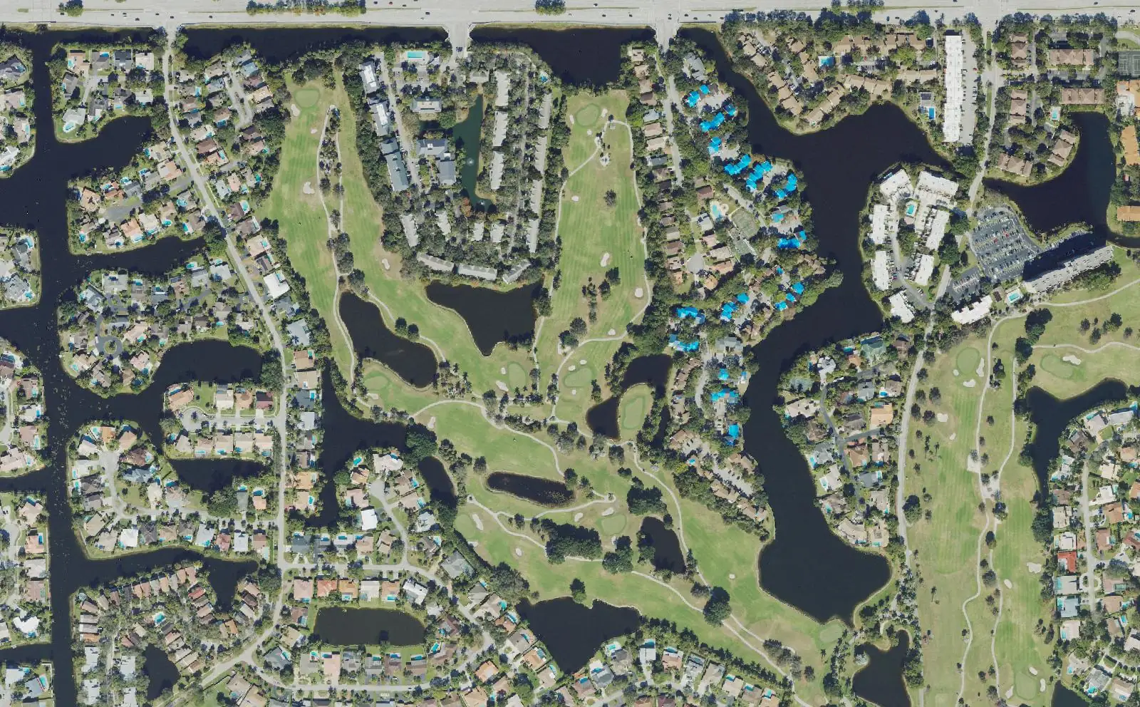
Jacaranda, about 1,430 acres between Pine Island and Nob Hill roads in ZIP 33324, splits at Broward Boulevard between Plantation High and South Plantation High.
Last checked Oct. 10, 2026. Sources: the Broward County Property Appraiser’s neighborhood layer; Broward County’s address points and school boundaries; the City of Plantation’s parks directory; the Florida Department of Education’s 2026 school grades; Zillow Research; Broward County Transit; and OpenStreetMap.
Jacaranda is the largest single neighborhood in the Broward County Property Appraiser’s records for Plantation: about 1,430 acres in the middle of the city, between Pine Island Road and Nob Hill Road, with a golf course winding through it and the city’s Central Park tucked into its northern edge. OpenStreetMap also marks it as a named neighborhood. Broward County’s address data counts about 2,690 street addresses here, all in one ZIP code.
What this means for you
- Zoned high school: Plantation High (B in Florida’s 2026 grades) north of Broward Boulevard; South Plantation High (A) south of it. Check yours with the district’s Find My School tool.
- Home value: $352,275 in ZIP 33324 in August 2026, according to the Zillow Home Value Index.
- Nearest interstate exit: I-595 exit 4, Nob Hill Road, about 1.6 miles by road.
Part of our Plantation neighborhoods guide.
Where it is
In the Property Appraiser’s neighborhood layer, Jacaranda runs from I-595 in the south to just above Cleary Boulevard in the north, with Pine Island Road along its east side and Nob Hill Road along its west side. Broward Boulevard and Peters Road cross it from east to west. The city’s Central Park sits in a notch on the north side that the layer leaves out, and Central Park Elementary is just across Nob Hill Road. Jacaranda Lakes is to the north, Midtown across Pine Island Road to the east, and Westport and Hawks Landing, separate neighborhoods in the layer, across Nob Hill Road to the west.
All of the area’s street addresses are in ZIP code 33324.
Schools
How the neighborhood’s addresses fall in Broward County’s 2025-26 school boundary layers, with each school’s 2026 grade from the Florida Department of Education. The percentage is the share of possible points the school earned.
| Level | School | Share of addresses | 2026 grade |
|---|---|---|---|
| Elementary | Peters Elementary, 851 NW 68th Ave. (report card) | 60% | B (59%) |
| Elementary | Tropical Elementary, 1500 SW 66th Ave. (report card) | 40% | B (61%) |
| Middle | Plantation Middle, 6600 W. Sunrise Blvd. (report card) | 60% | C (54%) |
| Middle | Seminole Middle, 6200 SW 16th St. (report card) | 40% | B (62%) |
| High | Plantation High, 6901 NW 16th St. (report card) | 60% | B (64%) |
| High | South Plantation High, 1300 Paladin Way (report card) | 40% | A (70%) |
Broward Boulevard is the line. Addresses north of it are zoned for Peters Elementary, Plantation Middle and Plantation High; addresses south of it for Tropical Elementary, Seminole Middle and South Plantation High. Central Park Elementary, just west of the area, does not serve Jacaranda addresses in the 2025-26 boundary data. Confirm an address with the district’s Find My School tool. More in our schools guide.
Home values
The typical home value in ZIP 33324 was $352,275 in August 2026, down 4.4% from $368,374 in August 2025, according to the Zillow Home Value Index. The index is a modeled typical value for the middle third of homes, single-family homes and condos together, not a sale price, and it covers the whole ZIP code, including Midtown’s apartments and condos, not just Jacaranda. The citywide Plantation figure was $495,099, down 2.1% on the year. More in our home prices guide.
Parks and trails
From the city’s parks directory:
- Central Park, 9151 NW 2nd St., in a notch on the area’s north side, with baseball, football and soccer fields, basketball and tennis courts, a pool, a water playground, a playground, pavilions and a walking trail.
- Cocoplum Park, 781 SW 90th Ave., a playground inside the neighborhood.
- Pine Island Park, 320 S. Pine Island Road, at the eastern edge, with soccer fields, an open play area, restrooms and a walking trail.
- Jacaranda Lakes Park, 1200 NW 94th Ave., about a quarter mile north, with basketball and tennis courts and a walking trail.
More in our parks and trails guide.
Getting around
- Interstate: I-595 exit 4, Nob Hill Road, about 1.6 miles by road from the middle of the area, or exit 5, Pine Island Road, about 1.9 miles.
- City Hall: about 2.4 miles to 400 NW 73rd Ave.
- Airport: about 10.5 miles to Fort Lauderdale-Hollywood International Airport.
- These are distances measured on the OpenStreetMap road network with the OSRM routing engine, not drive times.
- Bus: Broward County Transit Route 22 stops along Broward Boulevard and Route 88 along Pine Island Road, and Route 30 stops at Peters Road and Pine Island Road, in BCT’s published schedule data for summer 2026. BCT’s West Regional Terminal is just east of Pine Island Road at Broward Boulevard. Check current times on BCT’s website or at 954-357-8400.
More in our getting around guide.
Homeowners associations
The Property Appraiser’s neighborhood layer records an association named Jacaranda for the neighborhood. Association rules and fees are not public records we can check; ask for the governing documents before you buy.
Groceries and everyday stores
From OpenStreetMap:
- Publix, 10065 Cleary Blvd., at the northwest corner
- Publix, 550 N. Pine Island Road, across Pine Island Road
- ALDI, 8210 W. Broward Blvd., about a third of a mile east
- Winn-Dixie, 901 N. Nob Hill Road, a little under half a mile north
How we drew this area
This page uses the Jacaranda polygon in the Broward County Property Appraiser’s neighborhood layer, as published by Broward County GIS, and OpenStreetMap’s Jacaranda neighborhood name. Addresses and school shares come from every Broward County address point inside it, matched to the county’s 2025-26 school boundary layers on Oct. 10, 2026. Store locations are © OpenStreetMap contributors.
Frequently asked questions
What ZIP code is Jacaranda in Plantation?
- Every one of the roughly 2,690 street addresses in Jacaranda in Broward County’s address data is in that ZIP code. Zillow put the typical home value there at $352,275 in August 2026, down 4.4% on the year.
What high school is Jacaranda zoned for?
It depends which side of Broward Boulevard you are on. In Broward County’s 2025-26 school boundary data, addresses north of it (60%) are zoned for Plantation High, a B school in Florida’s 2026 grades, and addresses south of it (40%) for South Plantation High, an A school.
Is Jacaranda a good place to live?
Here are the facts. Jacaranda covers about 1,430 acres with about 2,690 street addresses, a golf course through the middle, Cocoplum Park inside it and the city’s Central Park on its northern edge. I-595 exit 4 is about 1.6 miles away by road, and City Hall about 2.4 miles.
Where does Jacaranda start and end?
In the Broward County Property Appraiser’s neighborhood layer, Jacaranda runs from I-595 north to just above Cleary Boulevard, between Pine Island Road on the east and Nob Hill Road on the west. Broward Boulevard and Peters Road cross it.
Have your say