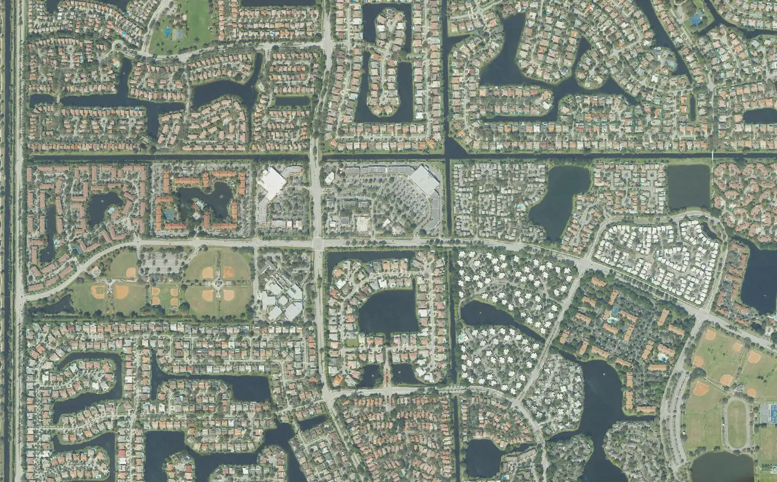
11 Plantation neighborhoods from Plantation Acres to Country Club Estates: ZIP codes, zoned schools with 2026 state grades and August 2026 Zillow values.
Last checked Oct. 10, 2026. Sources: the City of Plantation’s neighborhood plan reports and Midtown district map (Internet Archive copies, linked on each area page) and its parks directory; the Broward County Property Appraiser’s neighborhood layer, published by Broward County GIS; Broward County’s city boundaries, address points and 2025-26 school boundaries; the Florida Department of Education’s 2026 school grades; Zillow Research; the Census Bureau; and OpenStreetMap.
Plantation is a city of 96,293 people in central Broward County, according to the Census Bureau’s 2020-2024 American Community Survey. It covers about 22 square miles, stretching about 8 miles from State Road 7 on the east to the city limits west of Flamingo Road, and up to about 4.7 miles from north to south. I-595 runs along the southern edge, Florida’s Turnpike crosses the east side, Broward Boulevard runs through the middle and Sunrise Boulevard across the north. Midtown, the city’s district of offices, stores and apartments around Westfield Broward, sits between Pine Island Road and University Drive.
Three things to know before you look at a listing:
- Six ZIP codes with homes, most of them shared. Of about 20,900 street addresses inside the city in Broward County’s address data, 37% are in 33317 and 24% in 33324, the two ZIP codes Zillow files under Plantation; 20% are in 33322 and 5% in 33323, which Zillow files under Sunrise; 10% are in 33325, filed under Davie; and 3% are in 33313, filed under Lauderhill. A Plantation mailing address is not proof a home is inside the city.
- Two high school zones. In Broward County’s 2025-26 school boundary data, 63% of addresses in the city are zoned for Plantation High and 37% for South Plantation High. School zones do not follow city limits: the same layers zone about a third of Sunrise addresses for Plantation High. Always check one address with the district’s Find My School tool.
- Broward Boulevard often splits the zones. In Jacaranda and Midtown, addresses north of it go to Plantation High and addresses south of it to South Plantation High. See our schools guide.
The areas at a glance
Typical home value is the Zillow Home Value Index for the area’s main ZIP code in August 2026: a modeled typical value for the middle third of homes, single-family homes and condos together, not a sale price. It is a ZIP code figure, so it is the same for every area in that ZIP code. School grades are the Florida Department of Education’s 2026 grades.
| Area | ZIP | Zoned high school (2026 grade) | Typical home value (ZIP) | Guide |
|---|---|---|---|---|
| Plantation Acres | 33325, 33323 | Plantation (B); South Plantation (A) south of Broward Blvd. | $608,346 (33325) | Plantation Acres |
| Jacaranda | 33324 | Plantation (B) north of Broward Blvd., South Plantation (A) south | $352,275 | Jacaranda |
| Jacaranda Lakes | 33322 | Plantation (B) | $264,153 | Jacaranda Lakes |
| Lauderdale West | 33322 | Plantation (B) | $264,153 | Lauderdale West |
| Mirror Lake | 33313, 33322 | Plantation (B) | $159,878 (33313) | Mirror Lake |
| Midtown | 33324 | Plantation (B) north of Broward Blvd., South Plantation (A) south | $352,275 | Midtown |
| Plantation Gardens | 33317 | Plantation (B) | $543,429 | Plantation Gardens |
| Park East | 33317 | South Plantation (A) | $543,429 | Park East |
| Plantation Park | 33317 | South Plantation (A) | $543,429 | Plantation Park |
| Plantation Isles | 33317 | South Plantation (A) | $543,429 | Plantation Isles |
| Country Club Estates | 33317 | South Plantation (A) | $543,429 | Country Club Estates |
For comparison, the citywide Plantation figure was $495,099 in August 2026, down 2.1% from a year earlier. On the year, 33317 was down 0.5%, 33324 down 4.4%, 33322 down 5%, 33325 down 1.9%, 33323 down 1.7% and 33313 down 6.2%. More in our home prices guide.
Map of the areas
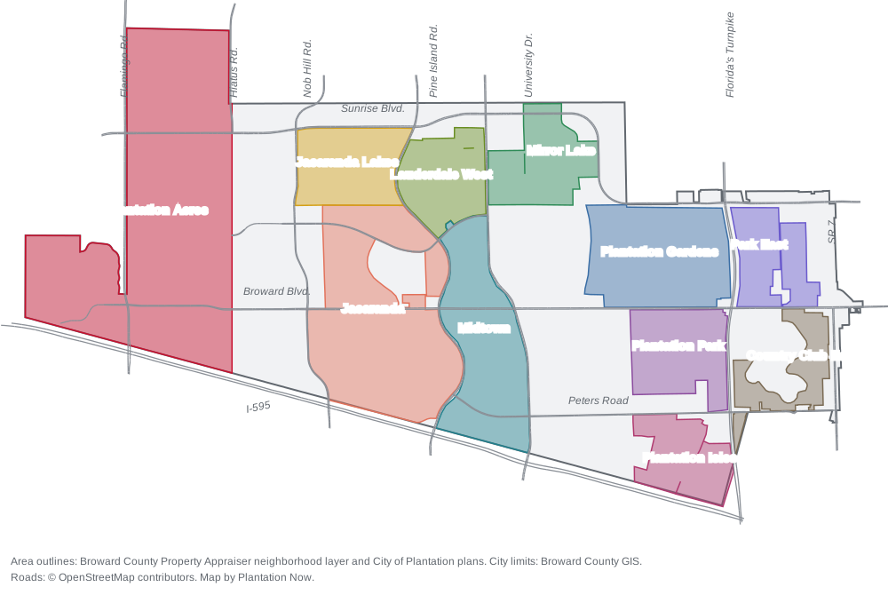
Map by Plantation Now. Area outlines are from the Broward County Property Appraiser’s neighborhood layer and the City of Plantation’s plans; city limits from Broward County GIS; roads © OpenStreetMap contributors.
The areas
Plantation Acres. The whole west end of the city, west of Hiatus Road: about 2,680 acres of large lots, annexed in 1973, with Volunteer Park and the city’s Equestrian Center.
Jacaranda. The largest single neighborhood in the county’s records for the city, about 1,430 acres between Pine Island and Nob Hill roads around a golf course, split between two high school zones at Broward Boulevard.
Jacaranda Lakes. About 490 acres of homes around lakes south of Sunrise Boulevard, all zoned for Central Park Elementary, an A school.
Lauderdale West. A community association built from 1972 between Pine Island Road and University Drive, which voted to join Plantation in 1974.
Mirror Lake. Mostly ranch-style homes east of University Drive, with Mirror Lake Elementary and Mirror Lake Park inside and Plantation High at the northern edge.
Midtown. The city’s district of offices and stores around Westfield Broward, with apartments and condos, the West Regional bus terminal and its own taxing district.
Plantation Gardens. The original 1940s neighborhood, which the city calls a historic district, with the library, Historical Museum and Plantation Woods park.
Park East. The northeast corner east of the Turnpike, built from 1958 around Breezeswept Park Estates, with five small city parks inside it.
Plantation Park. About 510 acres south of Broward Boulevard, next to the county’s Plantation Heritage Park, with every address zoned for two schools that earned an A in 2026.
Plantation Isles. Canal-front streets laid out from the late 1950s beside the New River Canal, next to South Plantation High.
Country Club Estates. Homes around the Fort Lauderdale Country Club golf course in the southeast corner, the closest area to the airport.
How Plantation compares with its neighbors on taxes, schools and home values: Plantation vs. Sunrise vs. Lauderhill vs. Davie.
How we built this
We named only areas a public source places on a map. The sources were:
- The City of Plantation’s neighborhood plan reports, written with residents between 2000 and 2005 for seven areas: Plantation Acres, Plantation Gardens Historic District, Park East, Country Club Estates, Plantation Isles/Harbor, Lauderdale West and Mirror Lake. The city’s website blocks automated readers, so we read the copies the Internet Archive saved in 2010; each area page links its plan. The city’s Midtown district map defines Midtown.
- The Broward County Property Appraiser’s neighborhood layer, published by Broward County GIS, which draws 61 named neighborhoods inside the city and records an association name for most of them. We used its outlines for every area except Plantation Acres, where we followed the plan’s Hiatus Road line, and Midtown, which we drew from road lines because the city’s map is an image. Jacaranda, Jacaranda Lakes and Plantation Park have no city plan; the layer names them, and OpenStreetMap also names Jacaranda and Plantation Park.
- Broward County’s address points, about 20,900 inside the city, used for ZIP code shares, and its 2025-26 school boundary layers, matched to every one of those addresses on Oct. 10. The 11 areas hold about 69% of the city’s addresses; neighborhoods such as Westport, Hawks Landing, Royal Palm Estates and Plantation Secluded Garden are in the county layer but have no city plan, so we did not give them pages. The district’s 2026-27 zones may differ; the Find My School tool is the final word.
- Distances measured on the OpenStreetMap road network with the OSRM routing engine; exit numbers from the Florida Department of Transportation’s interchange layer; bus routes from Broward County Transit’s published schedule data for summer 2026; parks from the city’s directory and Broward County’s parks layer; stores from OpenStreetMap, © OpenStreetMap contributors.
- Photos are from Wikimedia Commons; where no ground-level photo of an area exists, we used a public domain aerial photograph from the U.S. Department of Agriculture.
We do not rank areas. Every figure on these pages is from a named public source; if you see one that is out of date, tell us on our corrections page.
Related: schools, home prices, property taxes, getting around, parks and trails and moving to Plantation.
Frequently asked questions
What are the neighborhoods in Plantation, Florida?
The Broward County Property Appraiser’s neighborhood layer names 61 neighborhoods inside the city, and the city has published neighborhood plans for seven areas. Our guide covers 11: Plantation Acres, Jacaranda, Jacaranda Lakes, Lauderdale West, Mirror Lake, Midtown, Plantation Gardens, Park East, Plantation Park, Plantation Isles and Country Club Estates.
What ZIP codes are in Plantation?
Six with homes. Of about 20,900 street addresses inside the city in Broward County’s address data, 37% are in 33317, 24% in 33324, 20% in 33322, 10% in 33325, 5% in 33323 and 3% in 33313. Zillow files 33322 and 33323 under Sunrise, 33325 under Davie and 33313 under Lauderhill.
What high school is Plantation zoned for?
It depends on the address. In Broward County’s 2025-26 school boundary data, 63% of addresses in the city are zoned for Plantation High, a B school in Florida’s 2026 grades, and 37% for South Plantation High, an A school. Check a specific address with the district’s Find My School tool.
What is the oldest neighborhood in Plantation?
Plantation Gardens. The city’s neighborhood plan for it says the first houses went up along East Acre Drive in the 1940s, and the city held its first council meeting in a feed warehouse near East Acre Drive and Broward Boulevard in May 1953.
What are the main roads in Plantation?
Broward Boulevard runs east to west through the middle of the city and Sunrise Boulevard across the north. I-595 runs along the southern edge, Florida’s Turnpike crosses the east side, and University Drive and Pine Island Road run north to south through Midtown.
Have your say