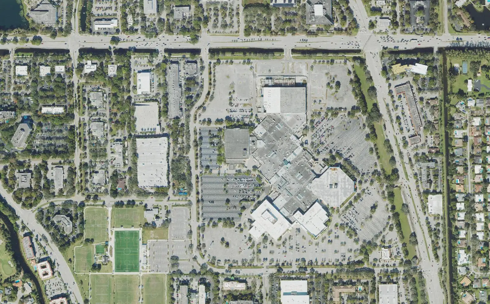
Plantation's Midtown district, between Pine Island Road and University Drive around Westfield Broward, is in ZIP 33324 and has its own 0.9707-mill tax district.
Last checked Oct. 10, 2026. Sources: the City of Plantation’s Plantation Midtown District map (PDF, Internet Archive copy) and parks directory; the Broward County Property Appraiser’s 2026 proposed vs 2025 final millage report (PDF) and neighborhood layer; Broward County’s school boundaries; the Florida Department of Education’s 2026 school grades; Zillow Research; Broward County Transit; and OpenStreetMap.
Midtown is the City of Plantation’s name for the district between Pine Island Road and University Drive around Westfield Broward mall: offices, shopping centers and apartment and condominium complexes. It is not a neighborhood of single-family streets; most homes here are in multifamily buildings. The area covers about 870 acres between the two roads, and it has its own taxing district.
What this means for you
- Zoned high school: Plantation High (B in Florida’s 2026 grades) north of Broward Boulevard; South Plantation High (A) south of it. Check yours with the district’s Find My School tool.
- Home value: $352,275 in ZIP 33324 in August 2026, according to the Zillow Home Value Index.
- Nearest interstate exit: I-595 exit 5, Pine Island Road, about 1.2 miles by road, the shortest trip to I-595 of any area in this guide.
Part of our Plantation neighborhoods guide.
Where it is
The city’s Plantation Midtown District map, drawn on a January 2009 aerial photo, shows the district between Pine Island Road, which curves along its west side past the Jacaranda golf course, and University Drive on the east, from I-595 in the south north past Broward Boulevard toward Cleary Boulevard, with a small piece east of University Drive north of Broward Boulevard. Peters Road crosses the south end. Inside it are:
- Westfield Broward, 8000 W. Broward Blvd., the regional mall, in OpenStreetMap
- Plantation Walk, 321 N. University Drive, the outdoor shopping and dining district at the eastern edge; see our Plantation Walk guide
- West Regional Library, 8601 W. Broward Blvd., a Broward County library, in OpenStreetMap
- Two condominium neighborhoods in the Property Appraiser’s neighborhood layer, San Tropez north of Broward Boulevard and Plantation Colony on Peters Road
The area’s homes are in ZIP code 33324.
A separate tax rate. Properties in the Plantation Midtown Development District pay that district’s operating rate in addition to the city, county and school rates: 0.9707 mills in 2025, the same rate proposed for 2026, according to the Broward County Property Appraiser’s millage report (PDF). A mill is $1 of tax per $1,000 of taxable value. Check a parcel’s bill on the Property Appraiser’s site. More in our property taxes guide.
Schools
Broward County’s address layer has few points for Midtown’s large complexes, so we checked the district’s 2025-26 school boundary layers by location instead of counting addresses. Grades are the Florida Department of Education’s 2026 school grades, with the share of possible points earned.
| Level | North of Broward Boulevard | South of Broward Boulevard |
|---|---|---|
| Elementary | Peters Elementary, 851 NW 68th Ave., B (59%) (report card) | Tropical Elementary, 1500 SW 66th Ave., B (61%) (report card) |
| Middle | Plantation Middle, 6600 W. Sunrise Blvd., C (54%) (report card) | Seminole Middle, 6200 SW 16th St., B (62%) (report card) |
| High | Plantation High, 6901 NW 16th St., B (64%) (report card) | South Plantation High, 1300 Paladin Way, A (70%) (report card) |
Imagine Schools Plantation Campus, a charter school at 8200 Peters Road inside the district, earned an A in 2026; families apply to it directly. Confirm an address with the district’s Find My School tool. More in our schools guide.
Home values
The typical home value in ZIP 33324 was $352,275 in August 2026, down 4.4% from $368,374 in August 2025, according to the Zillow Home Value Index. The index is a modeled typical value for the middle third of homes, single-family homes and condos together, not a sale price, and it covers the whole ZIP code, including Jacaranda, not just Midtown. The citywide Plantation figure was $495,099, down 2.1% on the year. More in our home prices guide.
Parks and trails
From the city’s parks directory:
- Pine Island Park, 320 S. Pine Island Road, at the district’s west edge, with soccer fields, an open play area, restrooms and a walking trail; it hosts the city’s Rock the Park concerts. See Rock the Park.
- Marcano Estates Park, 7851 S. Marcano Blvd., about three-tenths of a mile north.
- Cocoplum Park, 781 SW 90th Ave., about a third of a mile west in Jacaranda.
More in our parks and trails guide.
Getting around
- Interstate: I-595 exit 5, Pine Island Road, about 1.2 miles by road from the middle of the district, or exit 6, University Drive, about 1.5 miles.
- City Hall: about 1.5 miles to 400 NW 73rd Ave.
- Airport: about 9.1 miles to Fort Lauderdale-Hollywood International Airport.
- These are distances measured on the OpenStreetMap road network with the OSRM routing engine, not drive times.
- Bus: Broward County Transit’s West Regional Terminal is on Pine Island Road at Broward Boulevard. In BCT’s published schedule data for summer 2026, routes 2 and 81 stop along Broward Boulevard and University Drive, Route 12 at the mall, Route 22 along Broward Boulevard, Route 30 on Peters Road and Route 88 on Pine Island Road. Check current times on BCT’s website or at 954-357-8400.
More in our getting around guide.
Homeowners and condominium associations
The Property Appraiser’s neighborhood layer records associations named San Tropez and Plantation Colony. Most other homes in Midtown are in apartment or condominium complexes with their own management. Association rules and fees are not public records we can check; ask for the governing documents before you buy or sign a lease.
Groceries and everyday stores
From OpenStreetMap:
- Publix, 1181 S. University Drive, inside the district
- Publix, 550 N. Pine Island Road, at the northwest edge
- ALDI, 8210 W. Broward Blvd., inside the district
- Walgreens, 181 N. University Drive, at the eastern edge
- Whole Foods Market, 1903 S. University Drive, about a quarter mile south
How we drew this area
The city’s district map is an image, not a data layer, so we drew the area between Pine Island Road and University Drive from OpenStreetMap road lines, from I-595 to just south of Cleary Boulevard, leaving out the parts the Property Appraiser assigns to Jacaranda and Lauderdale West. School zones were checked at points across it in the county’s 2025-26 boundary layers on Oct. 10, 2026. Store and library locations are © OpenStreetMap contributors.
Frequently asked questions
Where is Midtown in Plantation?
The City of Plantation’s Midtown district map shows it between Pine Island Road and University Drive, from I-595 north past Broward Boulevard toward Cleary Boulevard. Westfield Broward mall, at 8000 W. Broward Blvd., is in the middle of it.
What schools serve Midtown Plantation?
In Broward County’s 2025-26 school boundary data, the part of Midtown north of Broward Boulevard is zoned for Peters Elementary, Plantation Middle and Plantation High, and the part south of it for Tropical Elementary, Seminole Middle and South Plantation High. South Plantation High earned an A in Florida’s 2026 grades.
Do Midtown Plantation properties pay an extra tax?
Properties in the district do. The Broward County Property Appraiser lists a Plantation Midtown Development District with an operating rate of 0.9707 mills for 2025, the same rate proposed for 2026, in addition to the city, county and school rates.
Is there a bus terminal in Midtown Plantation?
Broward County Transit’s West Regional Terminal is on Pine Island Road at Broward Boulevard, at the district’s west edge. In BCT’s summer 2026 schedule data, routes 2, 12, 22, 30, 81 and 88 stop in or beside Midtown.
Have your say